
Walk a Lancaster Street by Address
Begin with the physical address, not a name. Dallas Central Appraisal District, or DCAD, is Lancaster's current address-keyed source. Its account card separates the property location from the owner's mailing address and supplies the legal description that joins the appraisal entry to a recorded land instrument. A street directory search is strongest when it preserves the street address, DCAD account number, subdivision or lot and block, and the latest instrument reference together. A street number alone can be abbreviated, reused, or missing from an older record.
- Run the number and street name in the DCAD address search. Save the account number, situs address, legal description, owner of record, and current mailing address as separate fields.
- Open the same area in the Lancaster interactive maps. Use the parcel view to understand the street segment and the lot placement, then confirm ownership with DCAD or the County Clerk.
- Search the Dallas County Official Records Search by instrument number, owner or subdivision. Read the latest purchase deed before assuming a transfer was an ordinary sale.
- For a registration question, use the individual Texas voter route or make the separate statutory list request through Dallas County Elections. Neither path is a full household roll, and protected addresses are excluded.
- For a past occupant, consult Dallas Public Library or TSLAC directory and criss-cross material. Match the directory year to the address form and legal description before joining it to the parcel.
Each step narrows a different record question: location, owner, land transfer, registration, or historical occupant. It is safer to record a source date than to collapse those findings into one claim about who lives there now.
Search Lancaster Streets in DCAD
DCAD says its account number is the best key, but an owner name or correct address can work when that number is unavailable. For one address, enter a numeric street number and a street name without the street type. For a street segment, fill both range fields. The form treats the number and suite separately, and its City selector can limit the result. Street names need at least two characters, so the built-in search rules matter on short or abbreviated Lancaster street names.
| DCAD field | How it works for a street search |
|---|---|
| Address Number | Required for the address form; numbers only, with no suite letters. |
| Direction and Street Name | Direction is optional; Street Name is required, must be at least two characters, and omits Street, Drive, or Lane. |
| Building and Suite | Optional fields that keep unit information apart from the house number. |
| City | Optional selector that can narrow the address result to Lancaster where mapped. |
| Range From and To | Use both fields to browse a segment. Use one number for a single property. |
| Account Type and Map | Optional residential, commercial, or BPP controls, plus a visual parcel route. |
DCAD's address form is shown below. A percent sign works as a street-name wildcard, such as %oak, and a one-letter street needs a trailing wildcard. Use less information when a tight search returns nothing.
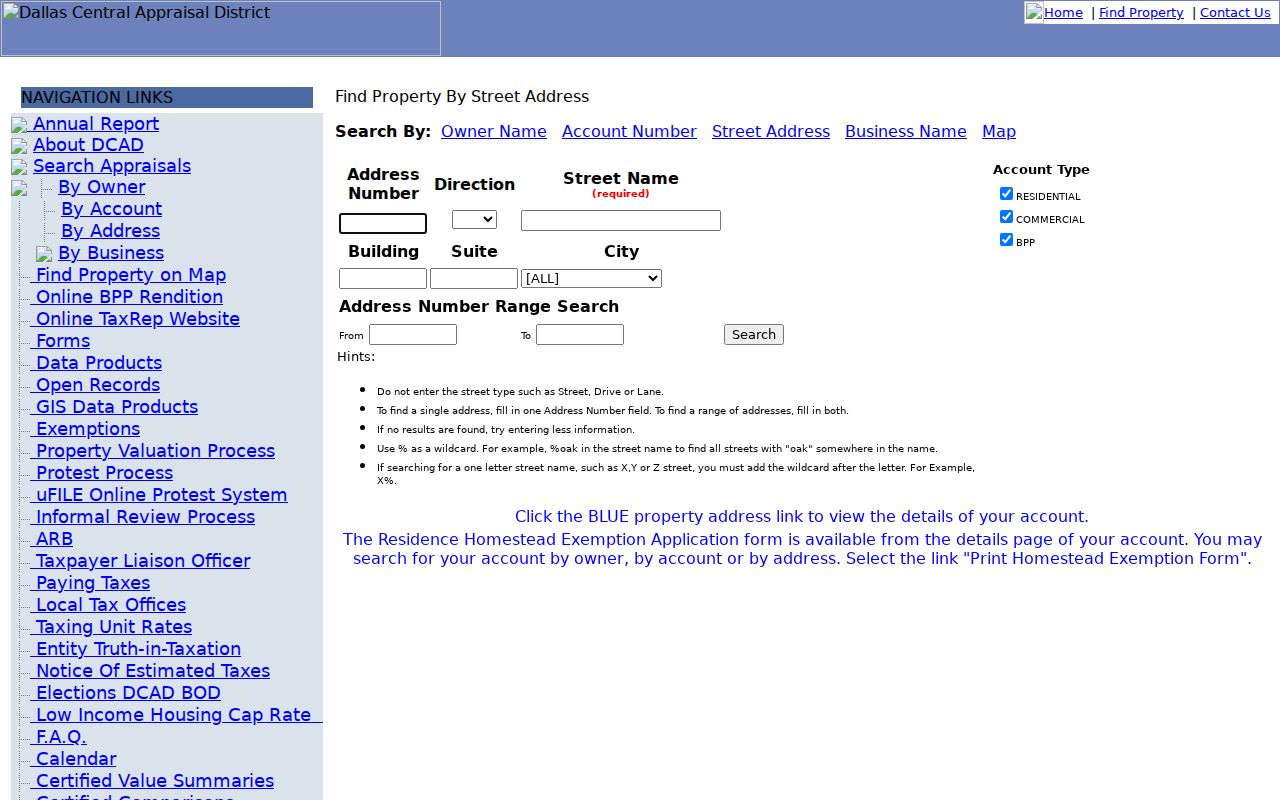
The form's range controls make it useful for a block-sized street directory search, but the resulting property address links still lead to appraisal cards, not proof of occupancy.
The DCAD residential account-detail example shows the kind of card reached from a blue property-address link. It separates current owner and mailing fields from the property location and links the account to maps and electronic documents.
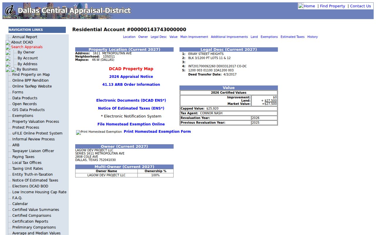
The account card can also show legal description, land and improvement information, exemptions, estimated taxes, and history. It remains an appraisal summary rather than the deed image or proof that every person at the address is an occupant.
Lancaster Street Searches Need the DCAD Key
DCAD identifies the account number as its best search key. An owner name or correct address can usually reach the same parcel when the number is not available, but the account number avoids confusion when a street has similar address forms or the owner receives tax mail elsewhere. Keep that number with the situs address, legal description, and current instrument reference. It is the cleanest connection between the Lancaster street directory result, the appraisal card, and a focused request to the district.
A useful address search starts broad enough to find the parcel, then becomes more exact. Do not replace the account number with a mailing address or a homestead flag. Those fields are informative, but they answer different questions about the recorded owner and property.
Read Lancaster Street Parcels on Maps
City maps are valuable for placing a result on the right side of a street. Lancaster publishes interactive, PDF, and static map material for zoning, existing and future land use, parcel size, public facilities, parks, sewer sheds, slope analysis, natural systems, thoroughfares, and special overlays. DCAD's documented map tools add Parcel Identify, Measure, Layers, Legend, Print, and Find. They can show which parcel belongs with an address or whether a nearby tract is a road, common area, or public facility.
The Lancaster interactive-map host page is shown here. The city says its GIS products are reference material that changes over time and is supplied without warranty, so a map click is a locating tool rather than title evidence.
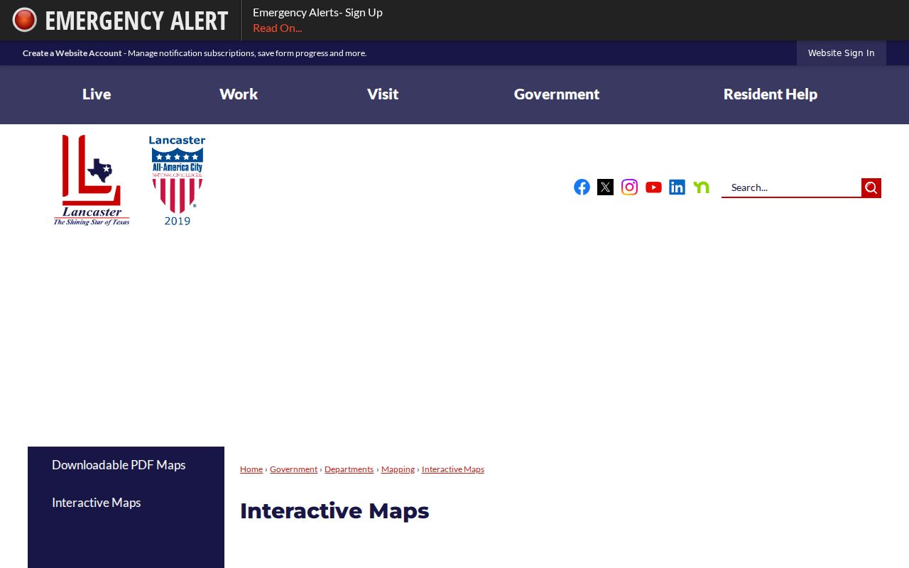
After locating the parcel, open its DCAD account and compare the legal description with a County Clerk deed or plat. That sequence prevents a street directory result from treating map geometry as the final ownership record.
Link Lancaster Street Records to Deeds
The Dallas County Clerk's Recording Division holds deeds, liens, releases, plats, and related official public records. The current Official Records Search offers quick and advanced paths, a recorded-date range, index-only or index-and-full-text OCR modes, and image-search controls. Its dynamic screen does not state a single starting year. For older land work, the Clerk's historical QuickLink path exposes Deed Record Index Books from 1846 through 1963, while the Clerk states that real-estate records have been digitized online from 1846 to current.
Start with the current DCAD instrument reference or legal description. Then work from buyer to seller, searching the latest grantor as an earlier grantee for the same lot, block, subdivision, or abstract. Include correction deeds, releases, liens, probate conveyances, and deeds of trust when the chain changes shape. A deed identifies a recorded interest in land, not every person who occupied the address.
The Dallas County official-records search is pictured below. Capture the instrument number and recorded date before ordering a copy, because index result rows may not include every detail from the document image.
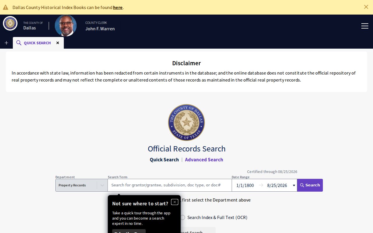
When an online result is incomplete, the County Clerk's document request form asks for such details as recorded name, grantor or grantee, instrument number, document type, and property address. It offers plain copies at $1 per page and certified copies at $1 per page plus $5 certification; the request needs approved payment and a prepaid return envelope.
Lancaster Street Records by Custodian
Address records are held by different offices. DCAD is the current parcel starting point. Lancaster GIS supplies the location context. The County Clerk holds recorded land instruments, while city offices retain permit and code material. A voter record can confirm a registered person's status or address only through the applicable individual or statutory list route, with protected data withheld. A historical criss-cross directory can add an older address-to-occupant clue, but the exact Lancaster run must be checked volume by volume.
| Address record | Custodian | What it can establish | Access route |
|---|---|---|---|
| Appraisal card | DCAD | Owner, mailing address, situs, legal description, improvements, exemptions, and history | Free web search, phone or counter, then a focused open-records request |
| Parcel GIS | City of Lancaster and DCAD | Parcel geometry, zoning, district, subdivision, and map context | Interactive map and GIS products; verify title with a recorded instrument |
| Deed or plat | Dallas County Clerk | Grantor, grantee, instrument, legal description, recording date, conveyance, or lien | OPR search, 1846-1963 QuickLink, counter, microfilm, or mailed copy request |
| Permit or inspection | Lancaster Development Services | Address, applicant or contractor, inspection request, and result timing | Contractor portal, phone, or public-records request; full public history was not located |
| Code notice or lien | Lancaster Code Compliance | Owner-of-record notice, violation, cure period, lien, or citation trail | Office or lien-email request; notices are not occupancy proof |
| Criss-cross directory | Dallas Public Library or TSLAC | Historical occupant or business by address | On-site directory or microfilm research; coverage varies |
The account number and legal description are more durable bridges than the street name. Street names change form in indexes, while a lot and block or abstract can carry the parcel into a deed, plat, or historic map.
Find Lancaster Address Permits and Notices
Lancaster's online permit and inspection portal lets registered contractors submit permit applications, view status, request inspections, and obtain results. The city information page did not expose public search fields or a complete historic permit index, so it is not sound to promise an address search where the research found none. Permit technicians can be reached at 972-218-1201 or 972-218-1205, and the inspection-request line is 972-227-2994. Requests received before 7:00 a.m. on a business day are made that day; later requests are made the next business day.
Code Compliance's notice process attaches another address trail. A notice is mailed to the owner of record, gives a standard ten-day cure period, and is followed by an address inspection. Unresolved work can move to a citation in Municipal Court. Code Compliance may also handle lien information, but its seven-business-day typical response and authorization rules mean a request should identify the parcel and record sought.
These city records can date construction, a complaint, or an administrative action. They do not establish that an owner, contractor, or cited party lived at the property.
Note: The public city page did not provide a complete historic permit index or a searchable field list, so contact or a written request is the documented fallback.
Read Lancaster Street Record Terms
Four labels keep a street directory search from mixing an appraisal clue with a land record. The County Clerk instrument or plat is the evidence for title and lot boundaries. DCAD and the city map help locate the property and connect that instrument to a present address.
- Parcel
- An appraisal or map unit representing a property tract. DCAD account numbers identify appraisal accounts, while the recorded deed defines the legal land interest.
- Situs address
- The physical property location used by DCAD, permits, GIS, and code records. It may differ from the owner's mailing address.
- Plat
- A recorded subdivision or lot map that shows the land layout, streets, easements, and lot or block references used with a deed.
- Criss-cross directory
- An address-first historical directory used to find an occupant or business from a street address. It is not a current household roster.
When an older street number seems wrong, compare the subdivision, lot, block, abstract, adjacent street, and map position. Lancaster-specific citywide renumbering or renaming date was not located in the research, so historical continuity should be verified from plats, deeds, maps, and street indexes rather than guessed.
Lancaster Street Clues from the 1857 Plat
Lancaster was platted around Centre Avenue and the town square in 1857, after its 1852 incorporation. Main Street and Dallas Avenue were major early thoroughfares, and the MK&T railroad helped form an eastern development edge. Those clues matter when a deed or preservation record uses an older lot or block reference instead of the street form expected by a modern street directory search.
Historic map material also uses the Hall's Branch, Downtown, East Side Strand, Keller Branch, and Town Square subdistrict names. They offer local context that a postal label cannot supply. Search the modern street form beside the form shown in the contemporaneous map or deed, then match that evidence to the legal description.
An Address Card Is Not a Household List
A DCAD card may show an owner name, tax mailing address, physical location, exemption, and map link. None of those fields proves every person living at the property. A homestead exemption is narrow owner-occupancy evidence, not a roster. Likewise, a voter record confirms registration information subject to confidentiality rules, while a directory entry is dated historical evidence. Use the source that matches the question and preserve the date it was checked.
Renters, children, guests, unregistered people, utility subscribers, and many other household members do not appear in a public street roll. DMV address data is restricted by the Driver's Privacy Protection Act and Texas Transportation Code chapter 730, and utility customer lists are not general public records.
Lawful Limits of a Lancaster Street Directory
Street and address records are appropriate for personal, lawful research, property history, civic questions, and record verification. They do not authorize repeated unwanted contact, threats, monitoring, or efforts to expose a protected address. Texas Penal Code sections 42.07 and 42.072 address harassment and stalking. A protected-voter marker, an Address Confidentiality Program substitute address, a redacted image, or a sealed file means the record is not displayed, not that a private address should be reconstructed from other sources.
Lawful use. Use Lancaster street records only for lawful personal research and verify facts with the custodian. Never use an address trail to stalk, harass, intimidate, or expose a protected person.
For a suspected deed-fraud filing, the County Clerk's property-fraud alert can send an email when an instrument is recorded, but it does not prevent filing. Preserve the alert and instrument number, then contact the Clerk and appropriate authorities rather than relying on an address search alone.